Laboratory for Bioproduction and Machinery
Comparative Analysis of Remote Sensing via Drone and On-the-go Soil Sensing via Veris U3: A Dynamic Approach
The primary objective of this study is to investigate the strengths and limitations of drone-based remote sensing and on-the-go Veris U3 sensor in agricultural contexts. Through a series of field trials, data encompassing various parameters including vegeta-tion index and soil properties were collected in parallel using both methodologies. As the same fertilizers have been consistently applied year after year, there arose a critical need to evaluate their ongoing necessity and effectiveness. To address this, the Veris soil sensor was deployed as a valuable tool in this study. The focus on utilizing Veris sensor and in-tegrating its data with other sources like NDVI from drones will contribute to under-standing of soil-plant interactions and enable data-driven decisions that can enhance crop productivity and sustainability.
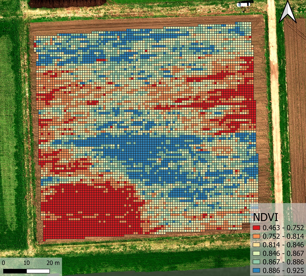
NDVI analysis distributed by grid 1x1m, July 2023, Muramatsu, Japan
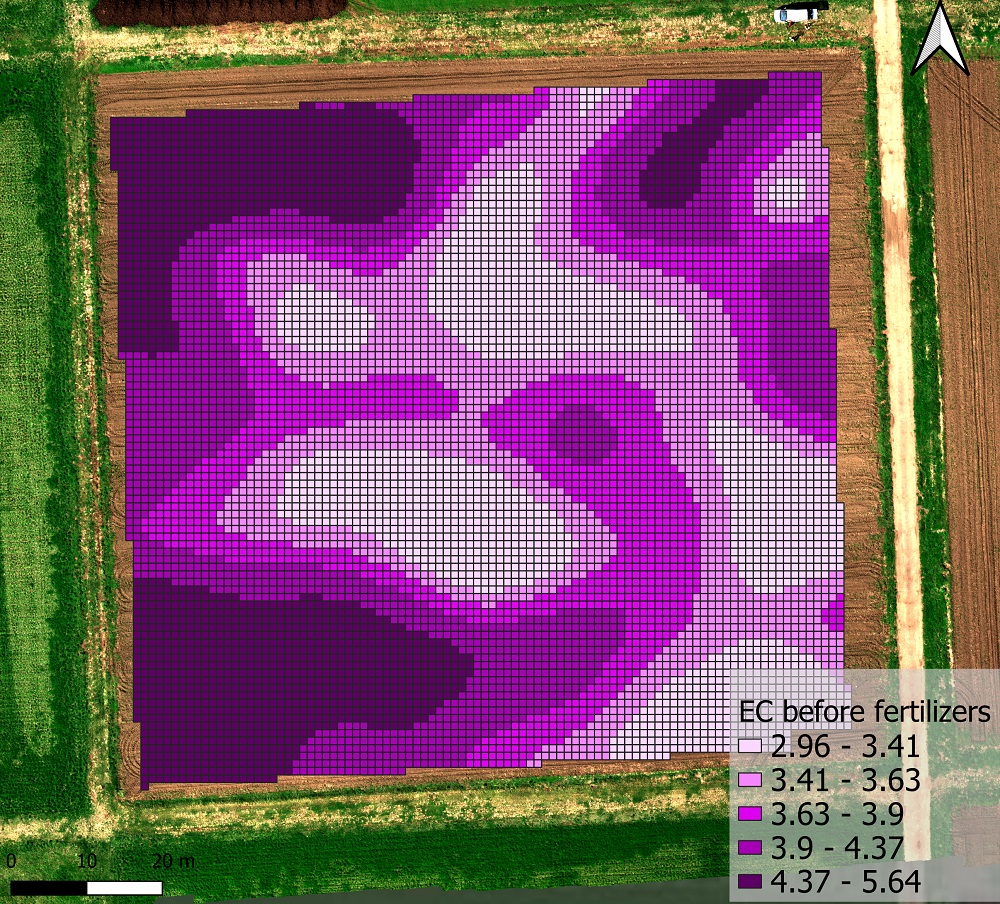
Soil EC data analysis interpolation by the Kriging method, surveyed before fertilizing, April 2023, Muramatsu, Japan
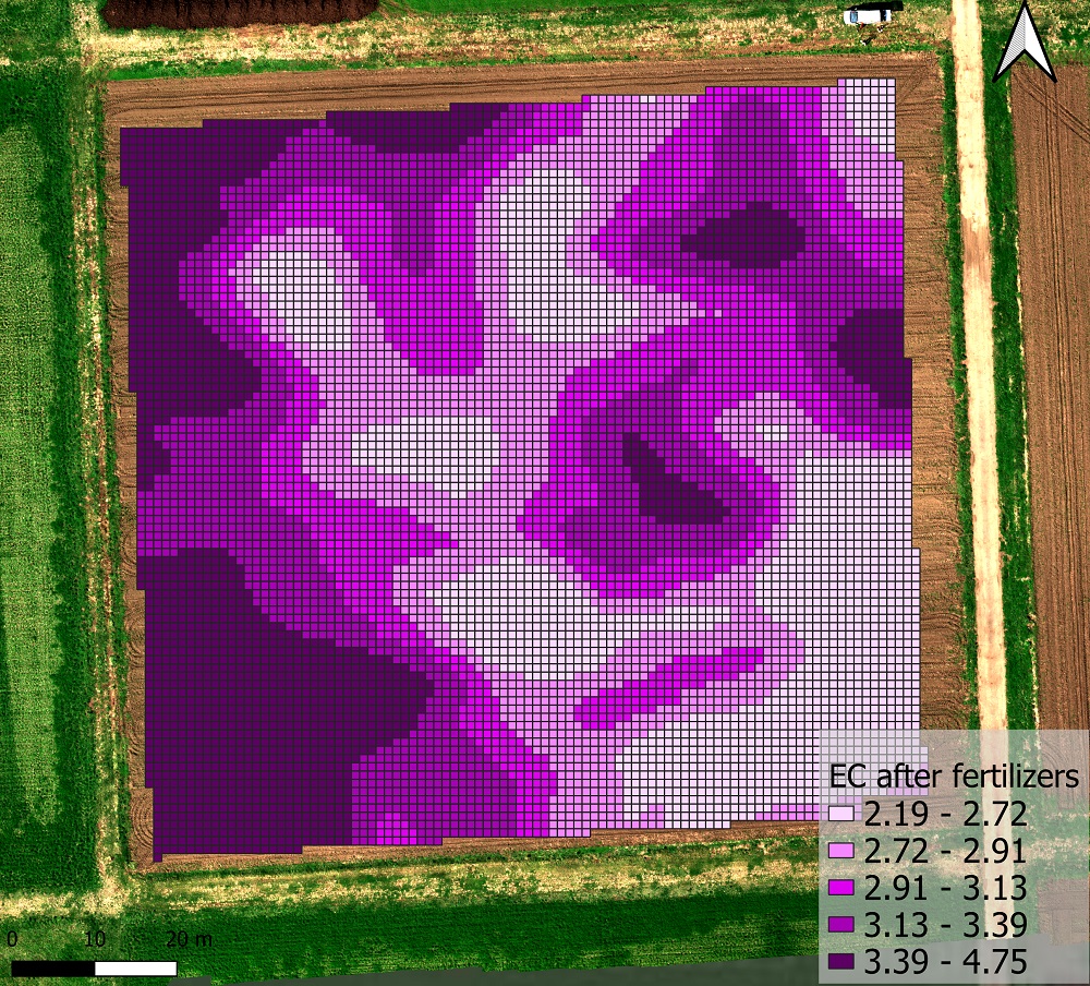
Soil EC data analysis interpolation by the Kriging method, surveyed after fertilizing, May 2023, Muramatsu, Japan
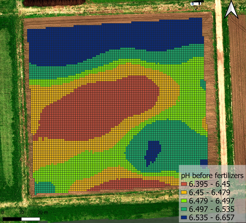
Soil pH data analysis interpolation by the Kriging method, surveyed before fertilizing, April 2023, Muramatsu, Japan
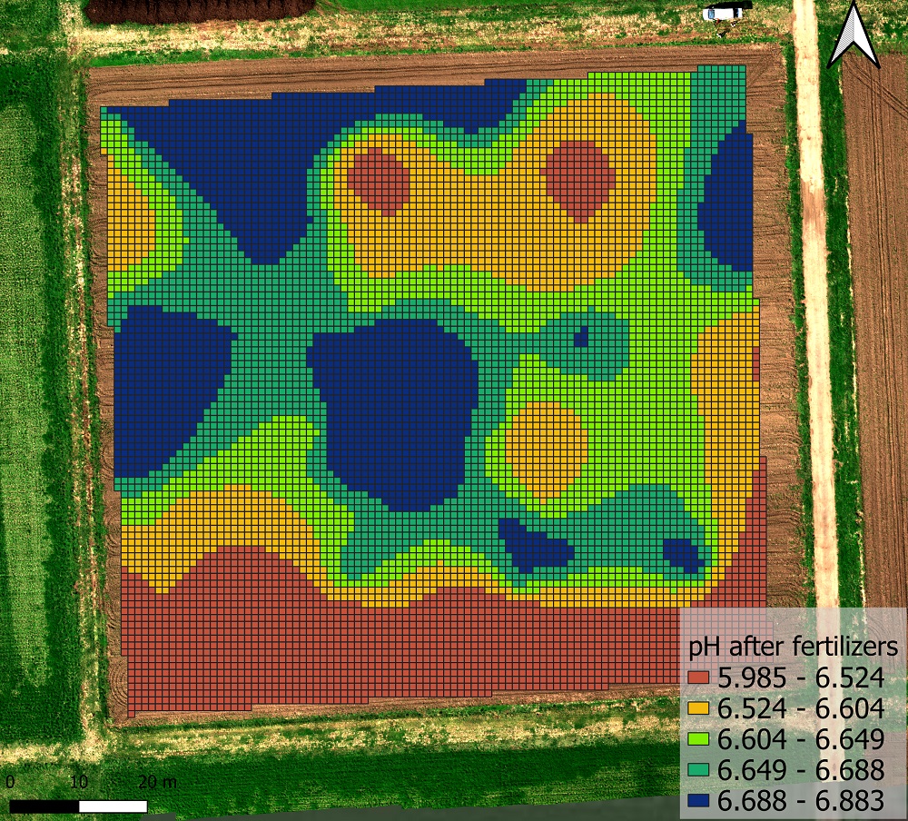
Soil pH data analysis interpolation by the Kriging method, surveyed after fertilizing, May 2023, Muramatsu, Japan
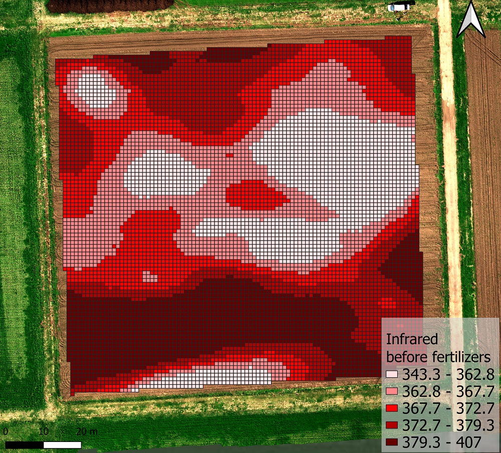
Soil IR data analysis interpolation by the Kriging method, surveyed before fertilizing, April 2023, Muramatsu, Japan
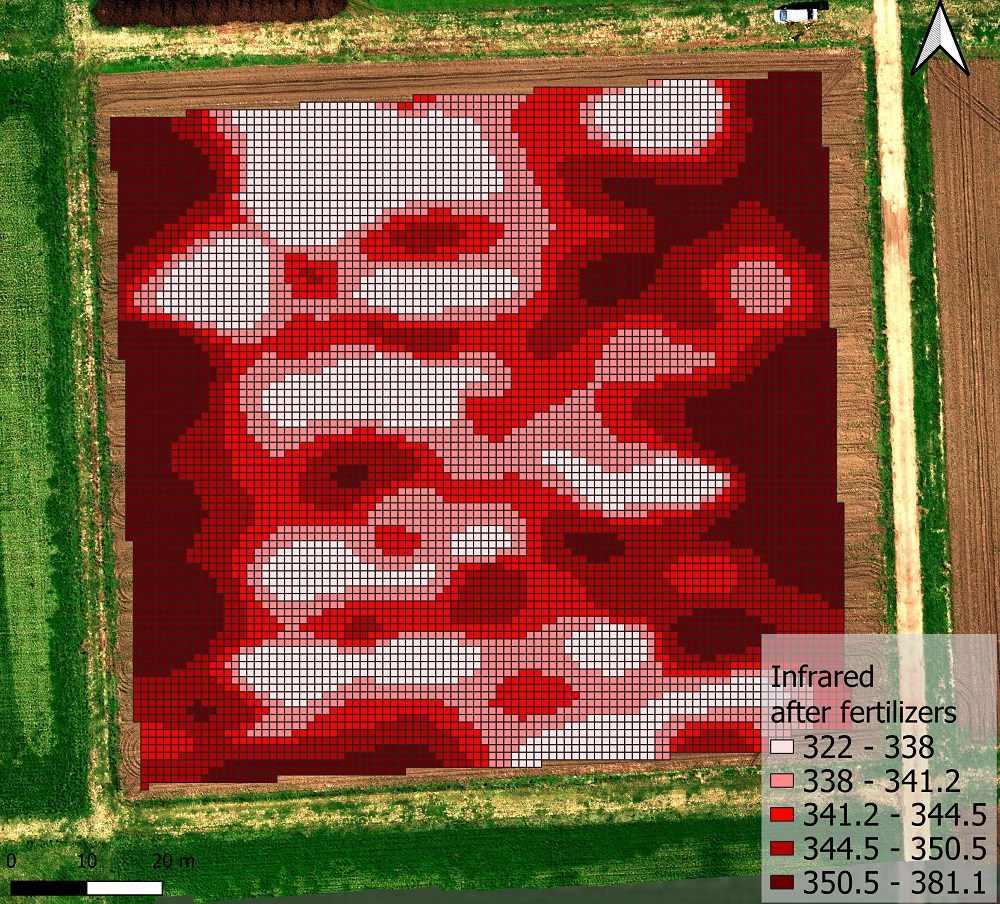
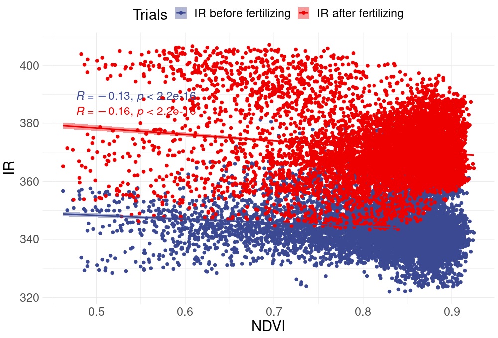
Soil IR data analysis interpolation by the Kriging method, surveyed after fertilizing, May 2023, Muramatsu, Japan
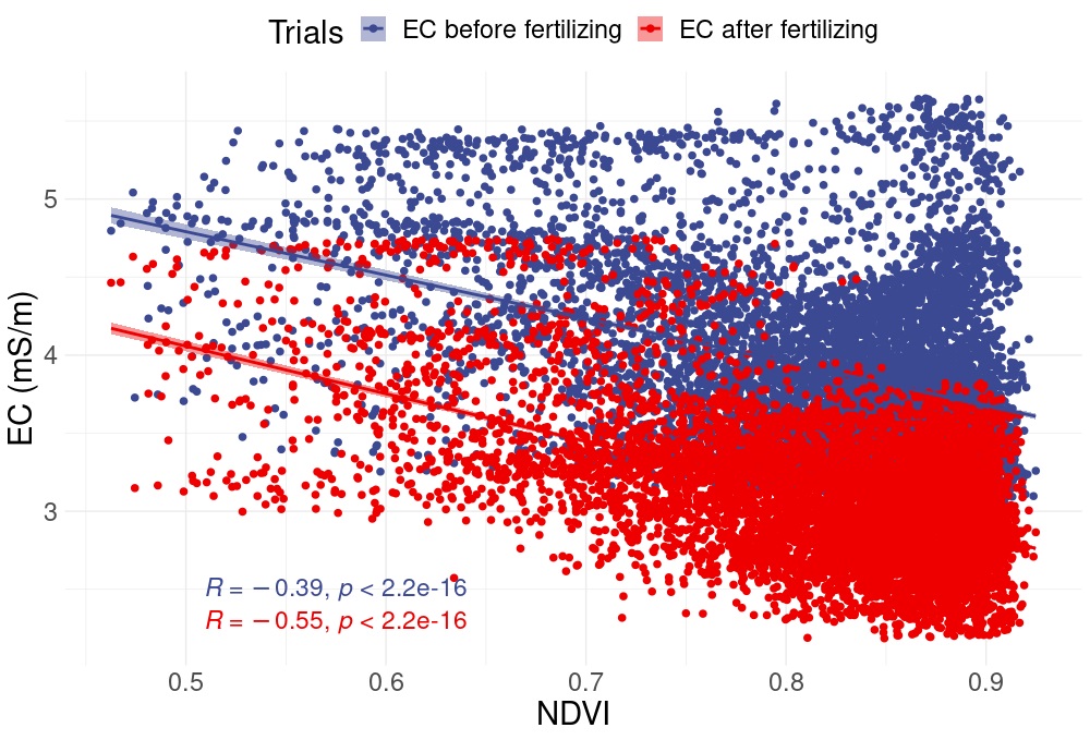
The relationship between drone-based remote sensing NDVI data and on-the-go ground-based soil sensing EC data before and after fertilization.
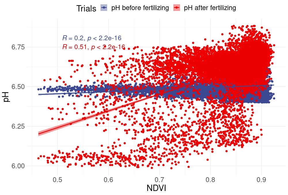
The relationship between drone-based remote sensing NDVI data and on-the-go ground-based soil sensing pH data before and after fertilization.